How did the Appalachian mountain range in the USA look like 22ky BP?
On another board an ISOT of that area from year 20000BCE to the present was mooted. My feeling is that it'd be tundra in the north - how far south would it reach? - and taiga in the south.
Already overrun by Amerindians mercilessly extirpating megafauna with their non sustainable traditional hunting ways? Or still humanfree?
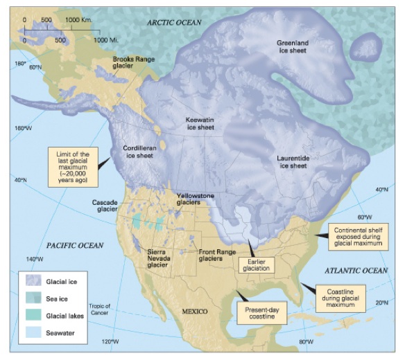
The ice sheet didn't actually extend far down the Appalachians, even in the depth of the last ice age:
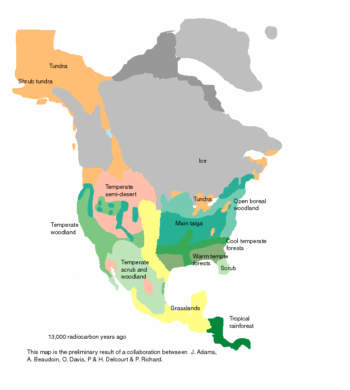
This is somewhat crude, and of a more recent stage, when the ice had already receded (compared to the above map, which more accurately reflects the situation 20.000 years BC). However, it shows the climate zones that you're interested in:
The combination of these maps allows for some extrapolation. We may assume that 20.000 years BC, a long 'finger' of tundra extended along the back of the Appalachians, from the Ice Sheet down to what is now Northernmost Georgia. Around it, there would be taiga, as the open boreal woodland we see wouldn't be able to persist there under those conditions (except for possibly a strip on the Atlantic shore -- a region that is now beneath the waves, of course, because sea levels have risen since).
The question of human habitation is an open one. We know for a fact that people reached the region by 14.000 BC. The conventional model has humans reaching the Americas via Beringia (and that, it is increasingly thought, probably via a coastal route, rather than an overland 'ice-free corridor') in the period of roughly 25.000 BC - 20.000 BC. So there could plausibly be paleo-indians in Appalachia, although I can't imagine them as anything other than very small groups of the very boldest pioneers. Most likely, they just weren't there yet.